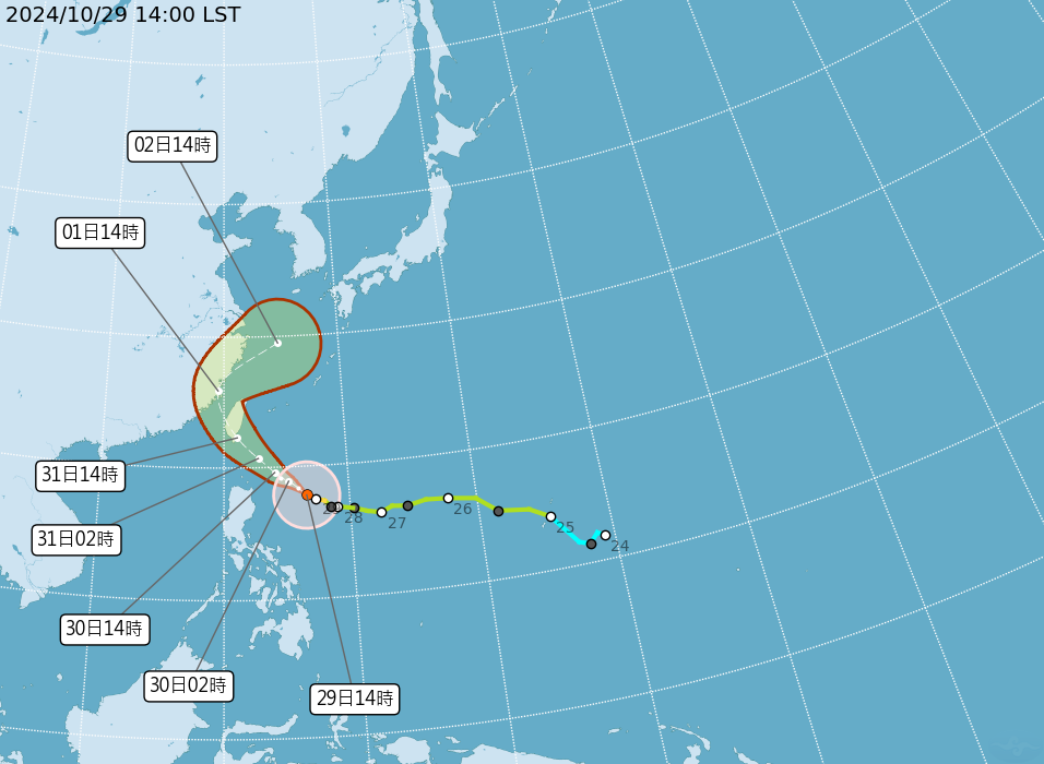
The Central Weather Administration (CWA) reported that Typhoon Kong-rey strengthened into a moderate typhoon on Tuesday. Moving northwest at a speed of 15 kilometers per hour, the storm is expected to make landfall in Taiwan’s Hualien-Taitung area on October 31.
As of 2 a.m., the typhoon was located approximately 940 kilometers east-southeast of Eluanbi. The typhoon currently packs a maximum wind speed of 35 meters per second.
During a weather report with SET News, Meteorologist Wu Te-jung (吳德榮) said European simulation models indicate that Kong-rey’s path may shift slightly southward, potentially hitting Taiwan’s southern tip, while American, Japanese, and Taiwanese forecasts maintain that both Taiwan and nearby seas remain in the path of possible impact.
Wu warned that the typhoon could strengthen further before reaching Taiwan, with the brunt of the impact expected from October 31 to November 1. The public is advised to make the necessary typhoon preparations, especially those in areas near the typhoon’s projected landfall location. The CWA will continue to issue updates and warnings as the typhoon’s path evolves.